The Sheltowee Trace NRT
/* Notice: Picasa stopped with their slide shows, prepare to scroll. */
TL;DR:
On the way to / from TNGA...
Eric: 'We should through ride the Sheltowee, looks like it's pretty much been a fail so far.'
Me: 'I'm down.'
Eric, after a few days on the trail: 'I hope you took the whole week off...'
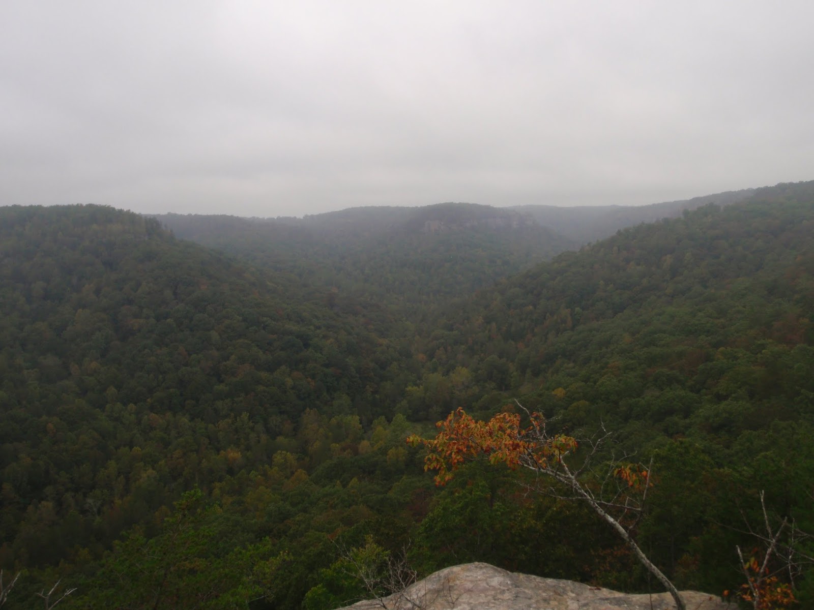
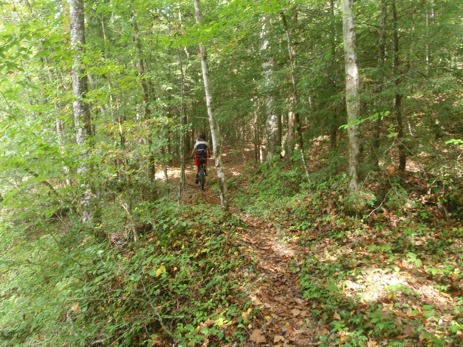
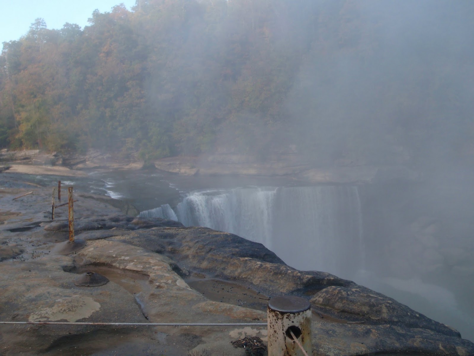
Funny how skipping the details, especially when there are few details to be found, is the appropriate fuel for the good idea of a fun bike ride. And in the spirit of adventure and keeping the octane high, I'll also be a bit terse on the tell and let the pictures do the show. The scenery, remoteness and solitude was amazing- the riding, equally more so. The dragging, pushing, lifting, carrying, scrambling, scraping, bushwhacking, two-manning up ladders... Yea. That's what makes the good times. And in retrospect, maybe a little bit of what we were looking for, we just didn't fully grasp it in the moment(s).
Notes:
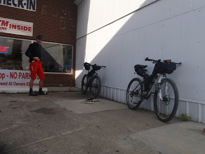
- 'Riding' is a misnomer for many reasons, have in mind that your bike will be a rolling pack mule every day on this route. One that you're going to have to kick in the rear every couple of minutes to get up some impossibly steep bumpy grade while navigating semi-off trail through a brush-whacking thicket of briars.
- Non-potable water is plentiful in most areas, however food resupply required going off route most times. The stores around the Cumberland River/Lake area are seasonal. We had several service spots turn up zilch, sending us rolling along on fumes. It took us three days to make the first resupply, which was luckily a Kroger. With a pre-filter screen and scoop cup, you could certainly run only tabs/drops for killing off the non-potable water bugs.
- Most of the trail proceeds through dry counties of Kentucky- pack your own libations. Aside from Morehead, there was only one other store we passed selling alcohol, near the Red River Gorge. And we failed to procure.?.?
- Stans, lots and lots of Stans. And thick sidewall tires. The trails are uber rough and gnarly, knobs ripped off your tires, titanium frame gouging and carbon frame impact cracking from rocks gnarly. The briars on the northern section were thick and plentiful- aside from tire issues, any soft shell clothing will get trashed with holes, snags and tears. Gaiters?
- I can't say I'd recommend through riding this route, however there are plenty of sweet sections which are link-able by roads. Leave a comment or contact me otherwise for advisement if you wish to do so.
Resources:
- Main Site
- USFS Site
- Mike's Bike and Hike (an omen?) is a good resource for shuttling and other trail condition information. http://www.mikeshikeandbike.com/
Route Map/Profile:

Stats:
372.9 miles - 76,866' of climbing
Prologue:
So this was Eric's idea. He did all the planning, scouting, setting up the shuttle, etc. I trained, waffled and was finally all in about a week from from departure. The weather looked perfect. Starting out with two nights / three days worth of food and the idea of picking up some tasty treats along the way, the plan was to make it to Morehead and do a fuel up for the final push to the car, which is about 27-ish miles away- so as to crank out the route in 4-5 days-ish. Hahahahahahahahahahaha. Seriously.


Epilogue:
In Morehead, behind the first alcohol advertisement plastered gas station, we sit like a couple of winos with paper bags over our bottles staring down the final 27-ish miles to the car, waffling if we should get a motel and a case of beer and ride in in the morning. At 5:16 pm, we rolled out. At 11:18 pm, each with a knock yourself a bit silly gnarly crash on the rocks in the dark, we arrived at the car. Typical speed on a typical day on the Sheltowee Trace, turtles and all.
TL;DR:
On the way to / from TNGA...
Eric: 'We should through ride the Sheltowee, looks like it's pretty much been a fail so far.'
Me: 'I'm down.'
Eric, after a few days on the trail: 'I hope you took the whole week off...'
Funny how skipping the details, especially when there are few details to be found, is the appropriate fuel for the good idea of a fun bike ride. And in the spirit of adventure and keeping the octane high, I'll also be a bit terse on the tell and let the pictures do the show. The scenery, remoteness and solitude was amazing- the riding, equally more so. The dragging, pushing, lifting, carrying, scrambling, scraping, bushwhacking, two-manning up ladders... Yea. That's what makes the good times. And in retrospect, maybe a little bit of what we were looking for, we just didn't fully grasp it in the moment(s).
Notes:
- 'Riding' is a misnomer for many reasons, have in mind that your bike will be a rolling pack mule every day on this route. One that you're going to have to kick in the rear every couple of minutes to get up some impossibly steep bumpy grade while navigating semi-off trail through a brush-whacking thicket of briars.
- Non-potable water is plentiful in most areas, however food resupply required going off route most times. The stores around the Cumberland River/Lake area are seasonal. We had several service spots turn up zilch, sending us rolling along on fumes. It took us three days to make the first resupply, which was luckily a Kroger. With a pre-filter screen and scoop cup, you could certainly run only tabs/drops for killing off the non-potable water bugs.
- Most of the trail proceeds through dry counties of Kentucky- pack your own libations. Aside from Morehead, there was only one other store we passed selling alcohol, near the Red River Gorge. And we failed to procure.?.?
- Stans, lots and lots of Stans. And thick sidewall tires. The trails are uber rough and gnarly, knobs ripped off your tires, titanium frame gouging and carbon frame impact cracking from rocks gnarly. The briars on the northern section were thick and plentiful- aside from tire issues, any soft shell clothing will get trashed with holes, snags and tears. Gaiters?
- I can't say I'd recommend through riding this route, however there are plenty of sweet sections which are link-able by roads. Leave a comment or contact me otherwise for advisement if you wish to do so.
Resources:
- Main Site
- USFS Site
- Mike's Bike and Hike (an omen?) is a good resource for shuttling and other trail condition information. http://www.mikeshikeandbike.com/
Route Map/Profile:

Stats:
372.9 miles - 76,866' of climbing
Prologue:
So this was Eric's idea. He did all the planning, scouting, setting up the shuttle, etc. I trained, waffled and was finally all in about a week from from departure. The weather looked perfect. Starting out with two nights / three days worth of food and the idea of picking up some tasty treats along the way, the plan was to make it to Morehead and do a fuel up for the final push to the car, which is about 27-ish miles away- so as to crank out the route in 4-5 days-ish. Hahahahahahahahahahaha. Seriously.
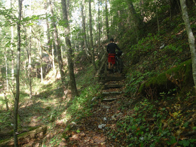
Day 1
 |
| Northern Terminus |
 |
| Southern Terminus |


 |
| Cross bridge spanning rocky crag... |
 |
| Lift bike over head and push it up said rocky crag... |
 |
| Pull yourself up via rope... |
 |
| Motor on. |

 |
| Yep, trail goes that way. |
 |
| Squeeze... |


Day 2


Day 3


Day 4


 |
| Oops. |

Day 5


 |
| Crossing over I-75. |


 |
| Halfway point before they added on the TN section. |

 |
| Matthew 'Not the Hurricane' Togger, you can read his through hike adventure here: http://www.trailjournals.com/about.cfm?trailname=21014 |

Day 6
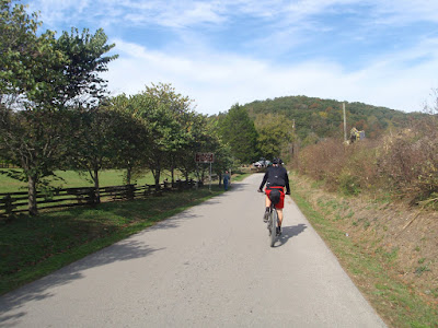
The photos are out of order, we started out riding through the Red River Gorge and then back onto the trail.


Day 7
 |
| Take heed to 'More Difficult', you can see the rocks hidden by the fallen leaves. |


 |
| No bikes on forest roads... Yet moto / ATV tracks? |
Epilogue:
In Morehead, behind the first alcohol advertisement plastered gas station, we sit like a couple of winos with paper bags over our bottles staring down the final 27-ish miles to the car, waffling if we should get a motel and a case of beer and ride in in the morning. At 5:16 pm, we rolled out. At 11:18 pm, each with a knock yourself a bit silly gnarly crash on the rocks in the dark, we arrived at the car. Typical speed on a typical day on the Sheltowee Trace, turtles and all.
posted by JimL at 11:00 AM
![]()
![]()

0 Comments:
Post a Comment
<< Home